135 Acre Eastern "Creek Lot"
and
75 Acre Western "Lake Lot"
This page contains extra information and VIDEOS about the Bladon Mentone Land on CR 520. Please look at Realtor.com or Zillow.com or other realty websites for main info and photos for the Creek Lot.
Sarah Bladon
sarahbladon@yahoo.com
(205) 908-8655 - text / call
Here is a multi-page DIRECTIONS doc with photos and descriptions of various areas of interest.
Maps
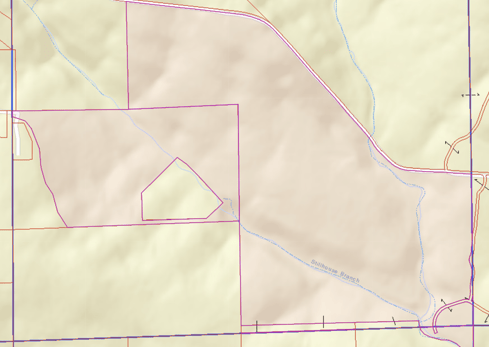
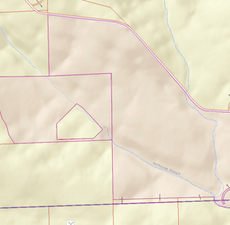
Tax map, Bladon owned property in pink. Lake is only shown on this map as the blue line of Stillhouse branch
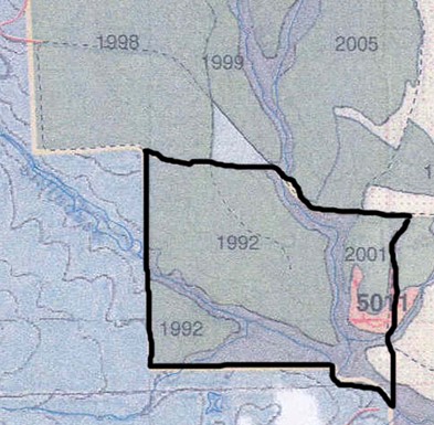
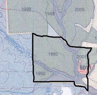
Pine Tree planting years, including surrounding land areas (Ignore black outline).
More than 2/3 of the Eastern Creek property is pine, mostly planted in 1992. If cutting is desired, they will be ready for final timber harvest soon, with super income potential.
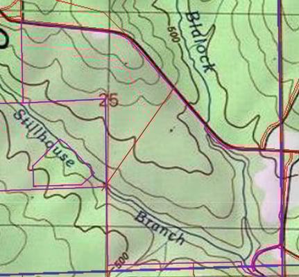
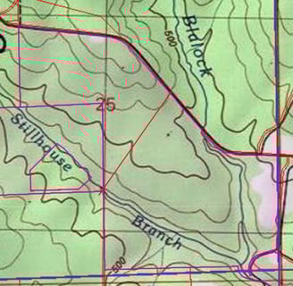
Topo map showing general gradual elevation changes. The road that is the Northern border of the property is the highest elevation. The creeks are low elevations, with the area in the SE where the two creeks converge being the lowest elevation.
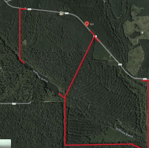
Google maps with rough outline of eastern 135 acre Creek lot and western 75 acre Lake lot. The 75 acre lot is not being marketed, but it is potentially available to someone who wants the whole of both lots or just the lake lot. The Lake lot has a higher cost per acre, since it is on a lake and closer to the main road.


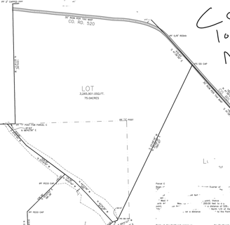
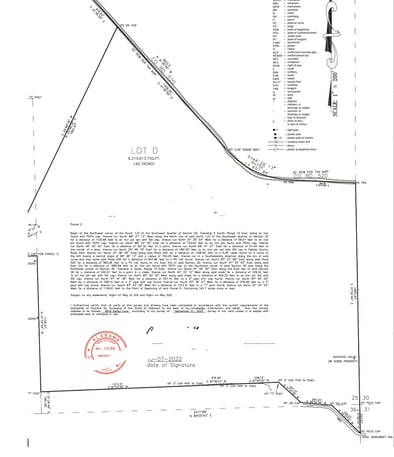
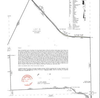
Survey
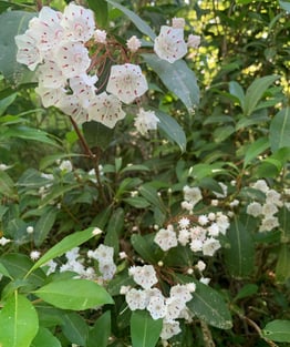
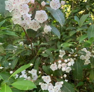
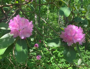
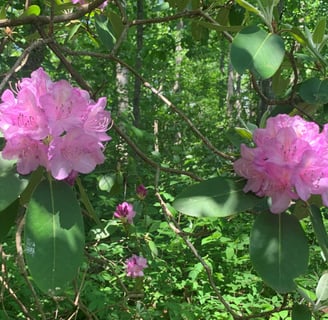
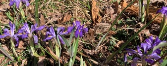
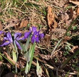
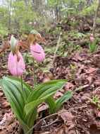
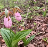
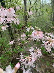
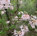
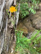
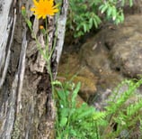
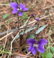
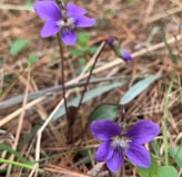
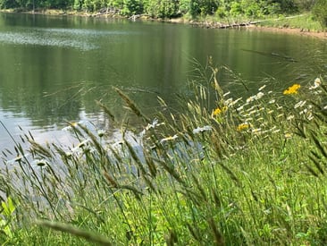
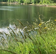
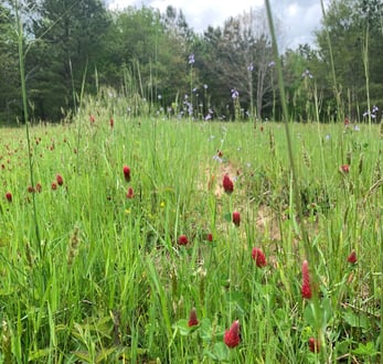
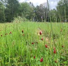
Hundreds of Mountain Laurel and Rhododendron are on the property, along with blooming flowers, trees, and shrubs. Wild blueberry, too!
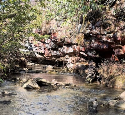
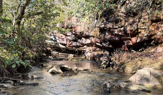
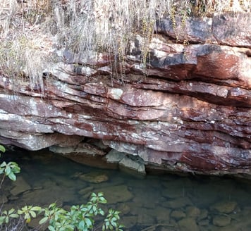
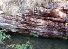
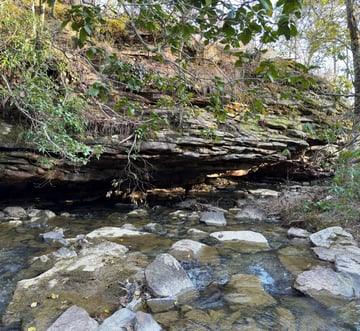
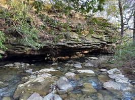
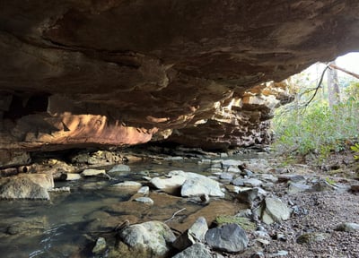
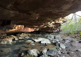
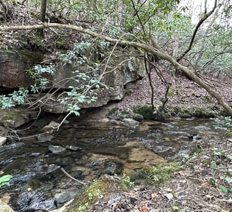
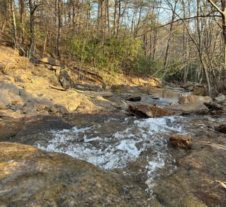
Cave / Rock Overhang over Blaylock Creek
SouthEast Corner. Two trails (just a 100 yards long each) are marked with orange triangular flag tied to trees on the main Eastern Border trail, near the southern end. BE CAREFUL - Upper trail leads by a huge drop off. Trail is for people willing and able to walk on slippery rocks to the other side of Blaylock Creek - do not attempt this other than at your own risk.
Video
Video

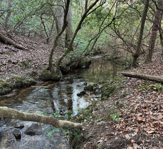

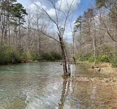
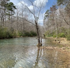
Convergence of Blaylock Creek and Stillhouse Creek
SouthEast Corner. Two trails (just a few moments walk each) are marked with orange triangular flags tied to trees on the main Eastern Border trail, near the southern end. The lower Confluence trail takes you to where the two creeks come together.
BE CAREFUL - upper Cave trail leads by a huge drop off. Both trails are for people willing and able to walk on slippery rocks to the other side of Blaylock Creek - do not attempt this other than at your own risk.
Video
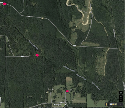
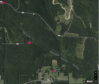
Electricity
is potentially available from a few nearby spots (3 pink dots on map)
Water
access is easiest by digging a well (filtered), popular in the area, and generally not difficult or deep.
75 acre Lake Lot
The western section of Bladon land (look at tax maps and surveys) is a 75 acre Lakefront lot. It has multiple areas which would make a great house site with complete privacy. The southern border is the approximate 1600' of lake and the northern border is the road that continues from CR 520.
This is not being marketed actively for sale, but people keep asking about it, and I am willing to sell it along with or separately from the eastern "Creek Lot" which is on the MLS/Realtor/Zillow. If I sell it alone, I am planning on keeping the other land for myself.
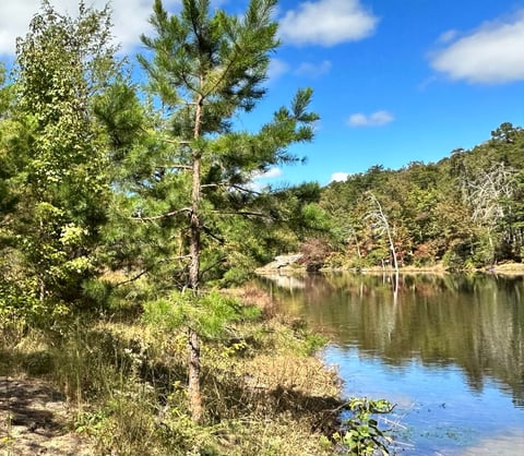
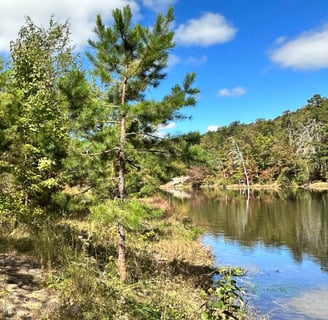
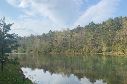
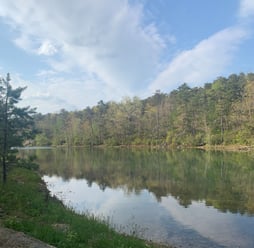
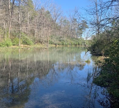
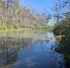
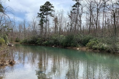
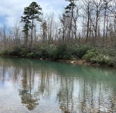
3 Photos at the very top of lake, taken from the southern side looking east, and northern side looking east and west, at the lake's narrowest point where it enters the property at only 50' wide, widening rapidly to become Emerald Lake.
The asking price for the 75 acre Lake Lot is $450,000
Video near western side of the Lake Lot, large meadow north of top of the lake. There are several small meadows in various locations throughout the properties.
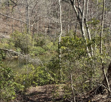
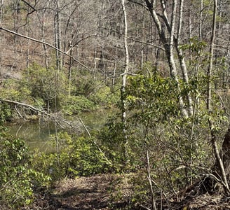
This video is a simple 30 second 360-degree view of a Possible House Site near the eastern edge of Lake area (75 acres or to combine). The lake is difficult to see in the video, but with a tiny bit of clearing just a few trees you have a great view of the top part of the lake. The lake is at its narrowest here, starting around 40' across as it enters the property and steadily widening to about 200' as it goes southeasterly, approximately 1600' long. There is NO other house visible from here, so complete privacy. Also ideal would be approximately 500' northeast of this, somewhat higher elevation on very gently sloping/ nearly flat area further from the lake. From there you get a bit more of eastern, southern, and western view to enjoy sunrise and sunset. Open up a winding path to the lake and have a small bankside dock to sit and enjoy the private lake with only views of nature.


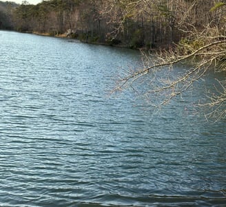
lake view from the center of the dam
Cascades, south edge of lake just below the dam.